Olympic Adventure Trail
Go to the The Hiking Project for a Virtual Tour

East Beach Road is OPEN!
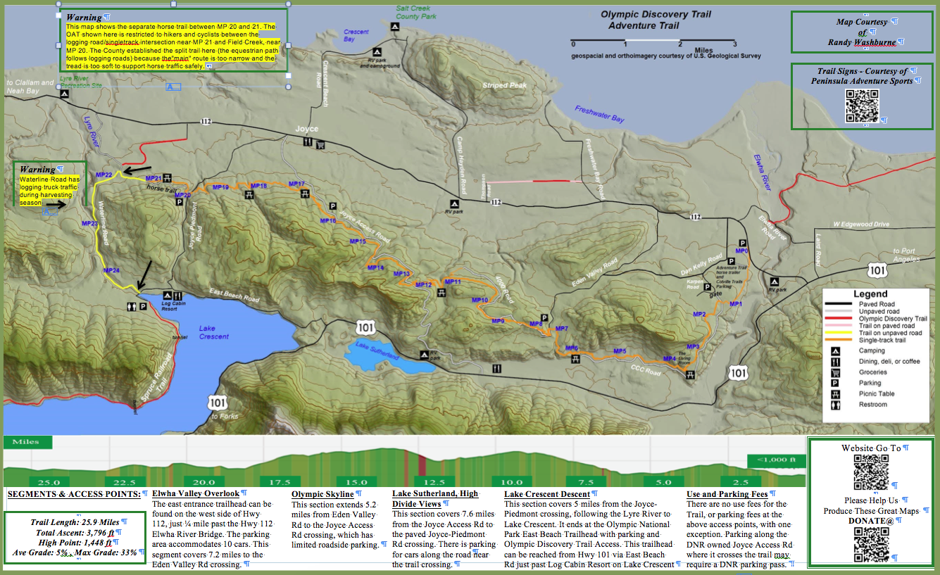
The Olympic Adventure Trail (OAT) is a 25 mile alternative to the paved, rail grade ODT route between the Elwha River and Lake Crescent. It was built by the Clallam County Sheriff’s Chain Gang under the direction of Sgt. Jon Beltrami, and by the Thursday Crew of Clallam County volunteers under the direction of Lorrie Mittmann and Jim Mantor. It is designed for mountain bikers, hikers, and equestrians. It has 25 miles of double and single track riding over very scenic, hilly, forested terrain. The trail is entirely off road except the last 4 miles on the west end, which is on old RR grade along the Lyre River and shared with logging access.
Download the Olympic Adventure Trail Map
Segments and Access Points
Elwha Valley Overlook
The east entrance trailhead can be found on the west side of Hwy 112, just ¼ mile past the Hwy 112 Elwha River Bridge. The parking area accommodates 10 cars. This segment covers 7.2 miles to the Eden Valley Rd crossing.
Olympic Skyline
This section extends 5.2 miles from Eden Valley Rd to the Joyce Access Rd crossing, which has limited roadside parking.
Lake Sutherland, High Divide Views
This section covers 7.6 miles from the Joyce Access Rd to the paved Joyce-Piedmont Rd crossing. There is parking for cars along the road near the trail crossing.
Lake Crescent Descent
This section covers 5 miles from the Joyce-Piedmont crossing, following the Lyre River to Lake Crescent. It ends at the Olympic National Park East Beach Trailhead with parking and Olympic Discovery Trail Access. This trailhead can be reached from Hwy 101 via East Beach Rd just past Log Cabin Resort on Lake Crescent.
Use and Parking Fees
There are no use fees for the Trail, or parking fees at the above access points, with one exception. Parking along the DNR owned Joyce Access Rd where it crosses the trail may require a DNR parking pass.
